Lights and Shadows Collection: Middle Eastern Moments
From an uncharacteristically sleepy view of the seaside village that would become the modern-day metropolis of Abu Dhabi to historical snapshots taken by pioneering women who explored and documented the people and landscapes of the region, this selection of photographs provides a glimpse of life in various Middle Eastern countries between 1881 and 1962. The images belong to the larger collection Lights and Shadows – Photographs from the Royal Geographical Society (with IBG), which presents an introduction to the Royal Geographical Society’s archive of over 500,000 historic images. Documenting and observing the world through photography has been a focus of the Society’s own work since the 1880s, when John Thomson was appointed as the Society’s official ‘Instructor of Photography’. Thomson referred to the medium as ‘the absolute lights and shadows of all things seen and that are of value in expanding our knowledge of the world in which we live’.
Wadi Du’an, Yemen
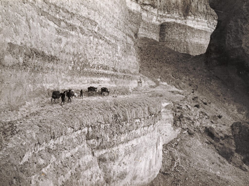
As a travel writer, Freya Stark was one of the first European women to explore the deserts of the Arabian Peninsula and achieved distinction in the 1930s by reaching the hinterland of Southern Arabia. Surpassing the achievements of contemporary male explorers, she also travelled widely in western Iran. She spoke fluent Arabic and Persian, and was also notable for her skills as a cartographer and photographer.
In 1934 she travelled for two months in the Hadhramaut, seeking the ancient city of Shabwa, mentioned by Pliny as a city with sixty temples and capital of the Land of Frankincense. Stark was the first European woman to record an intimate portrait of the people and landscape. In 1937 she began a major archaeological exploration of the Hadhramaut, this time traveling with archaeologist Gertrude Caton- Thompson. Remarking on changes in the landscape since her last visit, ‘the towns of the great Wadi, connected by a motor road with the coast and by a weekly aeroplane with Aden, were very different places from what I had known even four years ago on my first visit’. Stark sensed rapid change was a- foot and wanted to capture what she saw on camera.
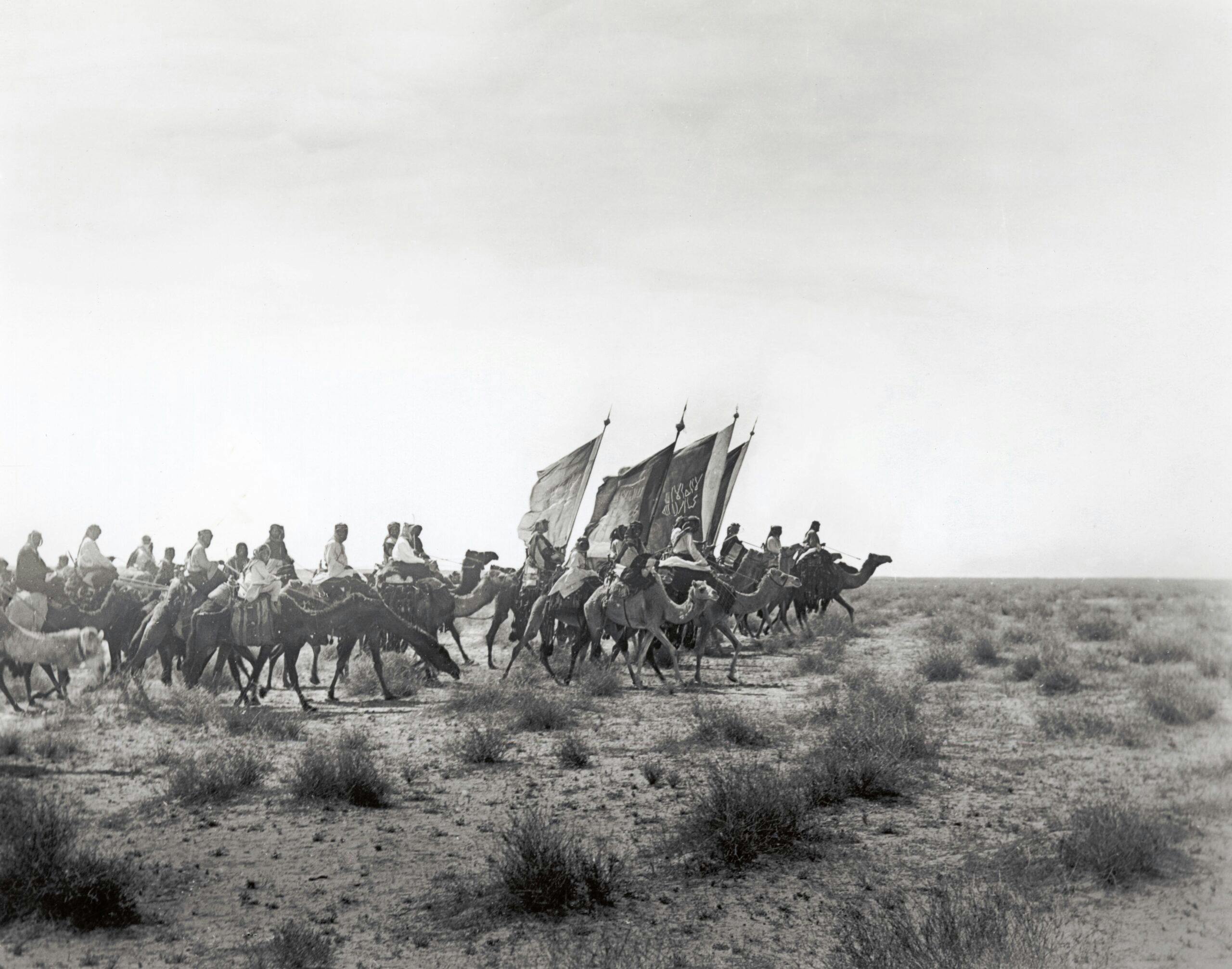
Ibn Saud’s Army on the March, Saudi Arabia
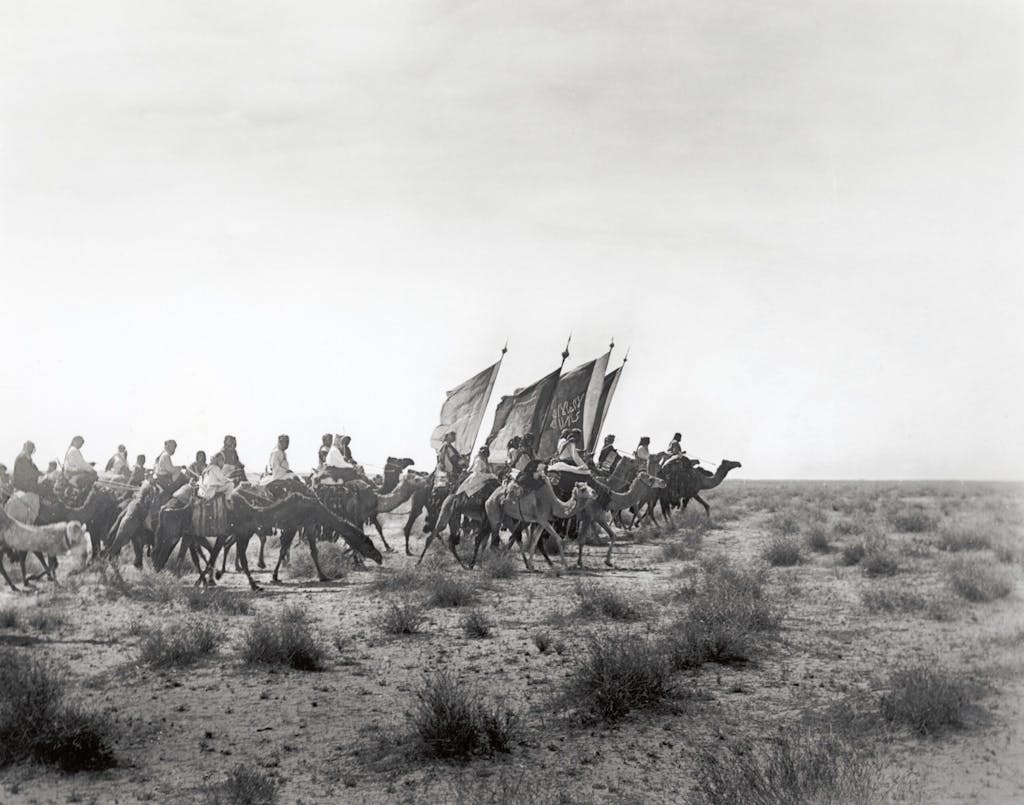
W.H.I. Shakespear was a British civil servant and explorer who mapped uncharted areas of Northern Arabia and made the first official British contact with Ibn Sa’ud, future ruler of Saudi Arabia. While in Kuwait, Shakespear made seven separate expeditions into the Arabian interior, during which he became a close friend of Ibn Sa’ud, then the Emir of the Nejd. It was Shakespear who arranged for Ibn Sa’ud to be photographed for the first time.
In March 1914, Shakespear began a 2,900-kilometre (1,800 mile) journey from Kuwait to Riyadh and on to Aqaba via the Nafud Desert, which he mapped and studied in great detail; the first European to do so. He was the military adviser to Ibn Saud from 1910 to 1915, when he was shot and killed in the Battle of Jarrab by one of Ibn Rashid’s men.
Tent of Fahad Bey, Abu Garah, Iraq
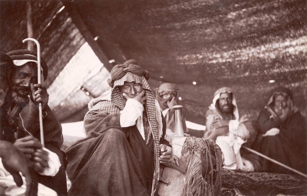
Gertrude Bell made her first visit to the Middle East in 1900 which established the future direction of her studies and led to her experience as one of the first European woman to live and work in the Arab World at the start of the twentieth century. At the outset of the First World War, her expertise was much in demand and in early 1915 she was asked to join the British Arab intelligence bureau, arriving in Cairo in November 1915.
At the conclusion of the war, as a British Political Officer, Bell drew up borders within Mesopotamia to include the three Ottoman Empire vilayets (or provinces) that later became Iraq. During her career, Bell frequently used photography as a method of observation to support her mapping and written documentation of architecture and archaeological sites, as well as creating a unique visual record of the people she encountered. Later, Bell began forming what would later become the Baghdad Archaeological Museum. She supervised excavations and examined finds and artifacts, once more using her camera to record site evidence.
She defied the accepted wisdom and insisted that the artifacts should not be transported to Europe but should remain in Iraq. The museum opened in June 1926 shortly before her untimely death.
Abu Dhabi from the air

A Fellow of the Society, Douglas Gordon was a British diplomat, active in the Middle East during the major part of his career. A keen traveler and photographer, his 1960s images of Abu Dhabi and Dubai taken c. 1961-3 and donated to the Society by Douglas and Caroline Gordon, provide us with an accurate photographic record of the landscape and vernacular architecture at a pivotal moment in the economic development of the region.
In the streets of Kandahar, Afghanistan
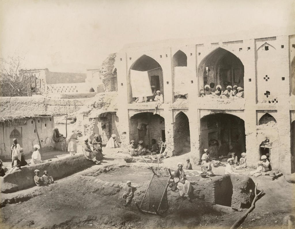
Sir Benjamin Simpson was a British military surgeon based in India who served in the Indian Medical Service in Bengal from 1853-1890. Following early ‘amateur’ photographic work in Bengal, he was transferred in the 1880s to Afghanistan, where he assumed the role of a war correspondent – arguably the first to be considered as such – during the British occupation of Kandahar. Simpson’s photographs were published under the title ‘From Kandahar’ by the Bourne Agency in Kolkata.
Simpson’s work was produced in an album format shared with images by John Burke (c.1843- 1900) and other photographers whose contributions still remain anonymous but are likely to be the works of a group from the ‘Photograph School of the Bengal Sappers and Miners’, trained by the Royal Engineers who recognized the value of photography as a valuable complement to their engineering work. A selection of such images was first publicly exhibited at the Photographic Society of Great Britain exhibition held in London in 1879.
This article has been produced in collaboration with Silversea’s Corporate Business Partner, the Royal Geographical Society (with IBG), which enriches guests’ expeditions with over 500 years of geographical travel and discovery. Find out more here.